
9/6/22
Wow.
Wow.
By the time my head hits the pillow tonight, I will have earned every morsel of sleep I can find.
I had thought that a 27-mile (42-km) bike day would be pretty easy. I went nearly that far yesterday, and barely felt it.
But I have never had a day on my bike that was so challenging, in so many unexpected ways, as today.
I’ll try to chronicle it all, but I will probably end up forgetting a few things (like multiple false starts/having to turn around, for a variety of reasons, and blackberry briars underfoot absolutely everywhere, threatening to puncture my tires). I’ve got extra photos today, too, because I wanted to capture all the mayhem.
It started with an early (for me) wake-up, at 6:15, because I wanted to get on the road by 8:00. (This was after having been awakened by my bladder at 3:25 am.)
I enjoyed peanut butter toast for breakfast, as I said farewell to Jane and Billy and thanked them for their hospitality.
Then the fun began.
First, I realized that once again, my phone service was not functioning in Canada. (I didn’t realize until I was nearly to the end of my trek that simply powering down the phone and re-starting it would solve this problem, which was painful because I had already made that realization a few months ago, in Quebec. Doh.)
So I had to make an almost immediate detour to a Safeway, to hover outside using their wifi, as I found the Google Maps route and then screenshotted 32 separate images of it to use for navigation. (I was also chagrined to know that there are ways of getting around this—like offline maps—but I can never remember how they work, so screenshotting was my method.) This added probably a good 20 minutes to my time.
I got back out on the road and was soon confronted by the road construction my hosts had warned me about. They are putting in bike lanes along King George—yay!—but the construction part is no fun for anyone, especially cyclists.
I made it through, and the motorists seemed pretty patient.
I made my first real mistake of the day when I needed to make my first left turn, onto Colebrook. Unbeknownst to me, there was also a Colebrook frontage road. (Really??) So I biked about 15 minutes along that road, enjoying the beautiful sunshine and complete lack of auto traffic, before encountering a dead-end fork, one side of which (on a gravel drive) said “Construction access only” and had signs about hard hats and such, and the other side said “No trespassing.”
Argh!
I really didn’t want to turn around. I stood there weighing my options, looking at maps, wondering if I could just sneak by somehow.
I decided to try the “no trespassing” side, since it appeared that I could pretty quickly and easily get onto Hwy 99 that way. This would not have been a fun highway to ride—I could see the heavy auto traffic whizzing by—but I couldn’t see a good alternative on my map, and figured I could turn north relatively quickly from there.
But then I reached another fork in the road, one side of which was full of workers in orange vests, and looked rather impassable, and the other of which led to blueberry fields and a worker standing next to a truck blocking the way.
I approached the truck and asked the worker if I could get to 99 from there. (As I got closer, the physical way appeared much more daunting and dubious.) He replied in Spanish that no, I would probably have to go back around the way I had come. We went back and forth a few times as I tried to recall enough Spanish to really confirm that this was the only option, and at the end it appeared it was.
Ugh.
Back around. I finally realized that the “real” (non-frontage) road was parallel to the road I was on. After another 15 minutes or so, I made it onto that road.
Before too long, my right turn onto the bike path showed up. That path was unpaved, as my hosts had warned me it would be, but the gravel surface seemed reasonable, as I had hoped it would be.
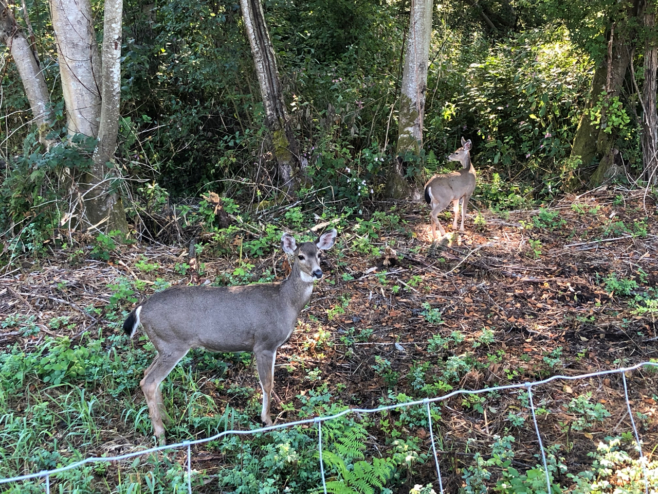
After a very short while, I spotted two beautiful deer enjoying some grass snacks in the morning light. They were kind enough to let me capture their likenesses.
Then up ahead the path bent to the left.

Soon after, the real obstacles began.
I wasn’t aware of this area having had much rain recently—I know it tends to be rare in this region during late August and early September—so I was flabbergasted to discover the dry path suddenly becoming a lake before my eyes.

You may recall that I have encountered similar watery obstacles on paths in Virginia and Pennsylvania (at least—maybe also other places I’ve forgotten) but this was the first time that there really was no way around it.
I would have to go through.
I was not happy about this, but as soon as my eyes had spotted the situation, my mind had leapt into action to imagine how I would handle it. I came up with a few options.
The one I ended up choosing was to open up the trailer and my suitcase, to change into my (rarely worn) sandals, and tie my athletic shoes and socks around the handlebars to keep them dry. I checked the depth of the water as best I could, and looked under the trailer to gauge its clearance. I really didn’t want to get water—especially potentially mucky water—on the bottom of the trailer.


Looked like I could make it.
So I waded through the water, pushing the bike and trailer together.
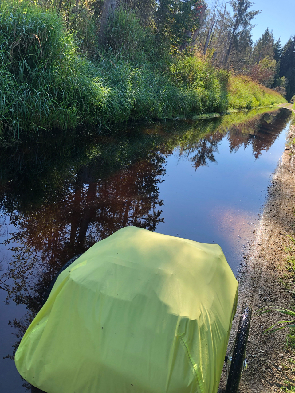
Made it through! Parked the rig, and walked back into the water to try to clean the mud off my sandals as best I could.
Then I re-mounted my steed, feeling quite proud of myself, and glad that the challenges of the day were behind me.
Needless to say, they were not.
Shortly I encountered several sections of nearly impassable large/coarse gravel, often accompanied by a dip in the path. There were several times I had to just walk the rig through it.
Interspersed with the large-gravel sections were a few other sections of fine, dusty sand, which were also un-rideable, and slow going to push through on foot.

I pressed on. It was a long path, but my screenshots showed me that by the end, I would reach the on-ramp for the long, tall bridge I would need to ride to cross the Fraser River.
But when I got within maybe 100 yards of the end of the path, I was met with “road closed” and construction signs.

You’ve got to be kidding.
Surely there is a way around this…
I walked past the first two signs, until I met the truck blocking the path. It would have been challenging to walk the rig around the truck (very narrow passage, and blackberry brambles on the path) and I also felt awkward about encountering the workers while trying to circumvent their signage.
I realized how futile it really was when I did park the rig and walk around the truck myself, to be met by the image of the path ahead thoroughly blocked by large downed trees, and an orange-vested worker slowly wrangling them.
There was no way I was getting through.
I suppose I haven’t yet mentioned that I had a Zoom call scheduled for 4:00. I thought I had given myself plenty of time to reach my Vancouver host, Maria, by 2:00 or 3:00 at the latest, but every one of these obstacles was costing me time, and I felt it every single time.
OK, don’t panic.
I looked at the map again, and realized my backtracking didn’t have to be as ridiculously long as I had feared. Rather than turning right to go out to the busy road instead of the path, I could turn left after 100 yards or so to get to the adjacent path.
OK!
But when I reached that intersection, the seemingly short distance to that other path looked nearly impossible.
First I had to lug the rig up onto a wooden boardwalk with no ramp, just a very tall lip.
Once I got it up there, I was nearly swallowed by the tall wet vegetation on both sides. Some of the boards were also decaying—and of course also covered by brambles—so at one point one wheel of the trailer fell off the path, and I worried the whole rig might break the boardwalk, or simply fall over the edge into the bog below.
Argh.
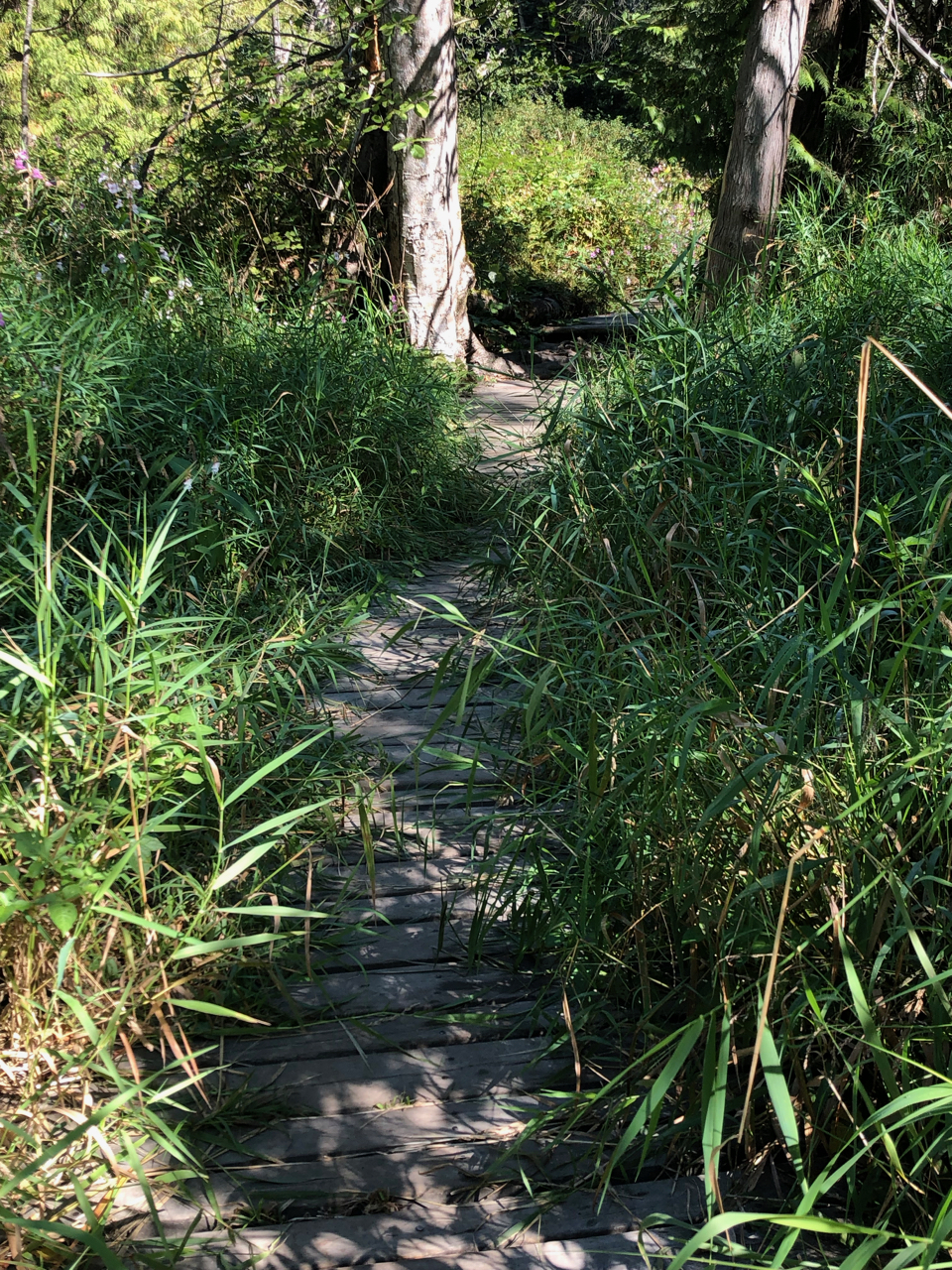
I managed to get the trailer back on the level, but was soon faced with a substantial break in the boardwalk—again, no ramps on either end—for some gnarly tree roots.
Great.

I hauled the rig awkwardly over them.
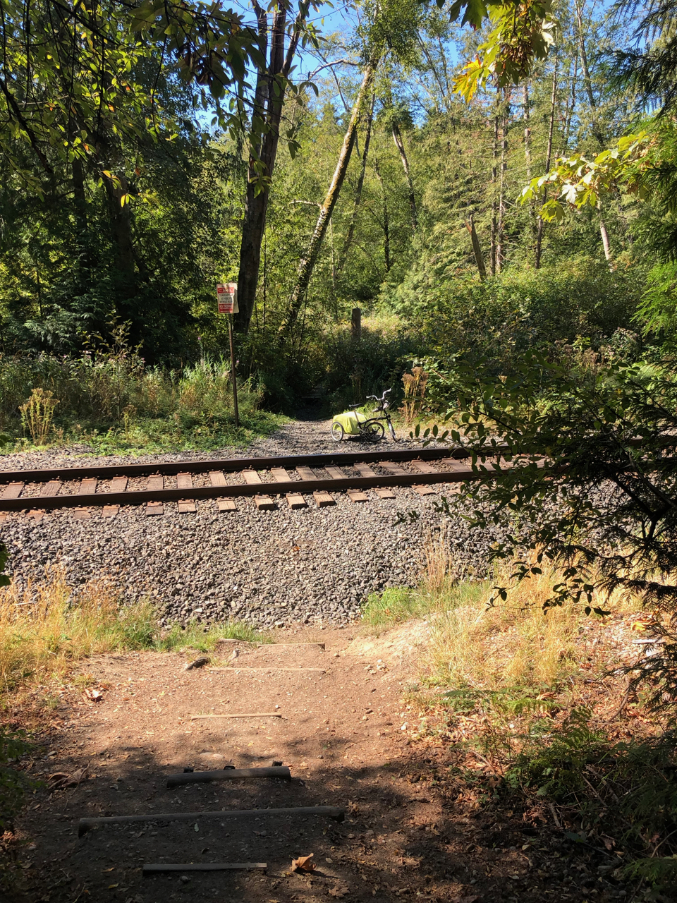
I finally reached the end of the boardwalk, and stepped into a clearing… filled with tall railroad tracks and a steep hill on the other side.
This can’t be happening.
At first I assumed that the tracks were the adjacent “path” that the map was showing me. I knew it was illegal—and quite possibly also dangerous—to walk alongside the tracks. Furthermore, I didn’t know how far I would have to take them, or how well I would be able to turn left from them, to reach the street I needed.
But I couldn’t think of a good alternative.
So I started clearing some of the worst brambles from the gravel next to the tracks.
Was this reality? It felt like a nightmare.
It was at that point that I suddenly saw that on the other side of the tracks was a steep stairway roughly built into the eroded hill.
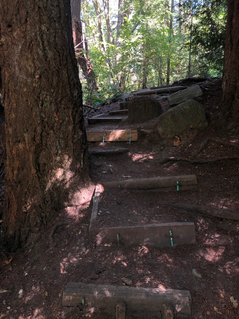
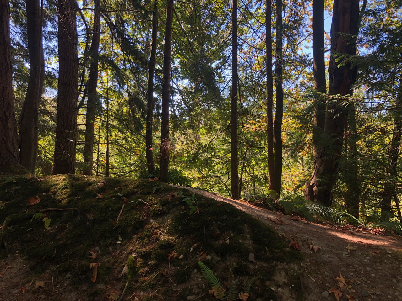
I ambled across the tracks to climb up it… and what should I find up there but an absolutely gorgeous bike-and-pedestrian path. It felt like the otherworldly Redwood Regional Park in Oakland, California. It was wide, and shady, and “paved” in crushed gravel and fallen tree needles.
I would love to be on that path.
But to get there, I would need to get the rig across those blasted railroad tracks, and then carry the components up that hill, piecemeal.
(That had been my initial thought of how I would need to get across that lake-puddle earlier. I was so relieved back then to realize I wouldn’t need to go to all that effort. But… now, I guess I would.)
I did know how to do it. I wasn’t happy about it. But I detached the trailer; removed the rain cover; extricated both bags from it; re-zipped it; and then made three trips across the tracks and up the hillside staircase: bike first, trailer next, bags last.

I had made it to the promised path!

I sat down on a boulder to rest and reflect and have a snack, and then resumed my mission. I made a few false starts getting off that path, needing to backtrack at least twice. But eventually I got out and made it onto the neighboring suburban streets.
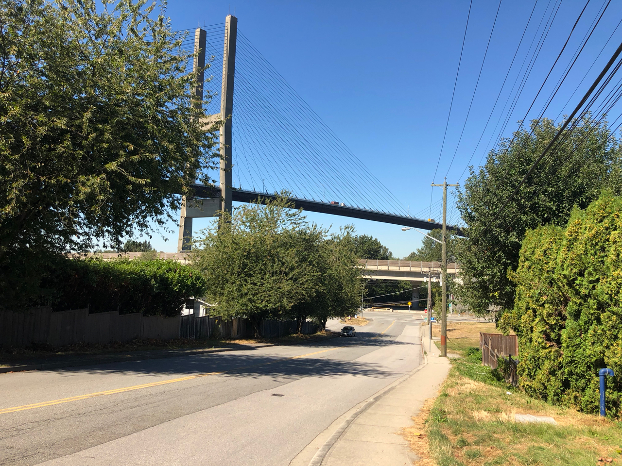
Now I would need to figure out how to get onto that Alex Fraser Bridge. I had been stymied by the blockaded path from getting on way back earlier, where the climb began. I looked at the map to see if I could instead access it from nearly underneath, where I was now.
Nope. Not a chance. I looked at the bridge and the road below, and saw that there was no way I could do it.
Seriously??
OK, now what? Should I consider taking another bridge? My hosts had warned me that that bridge was long and steep, and others were gentler. But they had also conceded that the other bridges would add significant time and distance to my route, so ultimately they advised me to go with the Google Maps plan to take this one.
But I weighed my options. How could I even get back to the bike on-ramp for that bridge? Maybe I should head east—out of my way—to find the next one? Or maybe west—even more out of my way—to get the other one?
Time was running short.
Ultimately, I decided to stick with the Alex Fraser Bridge. This meant a significant backtrack, through a very industrial area filled with shipping containers and enormous trucks sharing the road with me.

I finally made it to the on-ramp, then realized I was on the wrong side of the bridge, so I backtracked and got to the other side.
And then that climb began.

Oof.
I was so over this day already, and I had been on the road about five hours by then, I think. I was about halfway to my destination, which I had calculated would take me a total of six hours.
No phone or internet access to contact my host, nor the person I would be Zooming with.
OK. Onward.
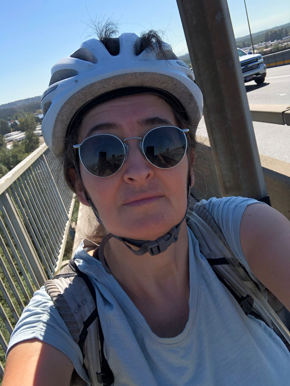
I made it across the bridge, and even stopped briefly to admire the beautiful river I was crossing.

On the other side, there were hills to climb, several of which I ended up walking.
I was hot.
Thirsty.
Tired.
Cranky.
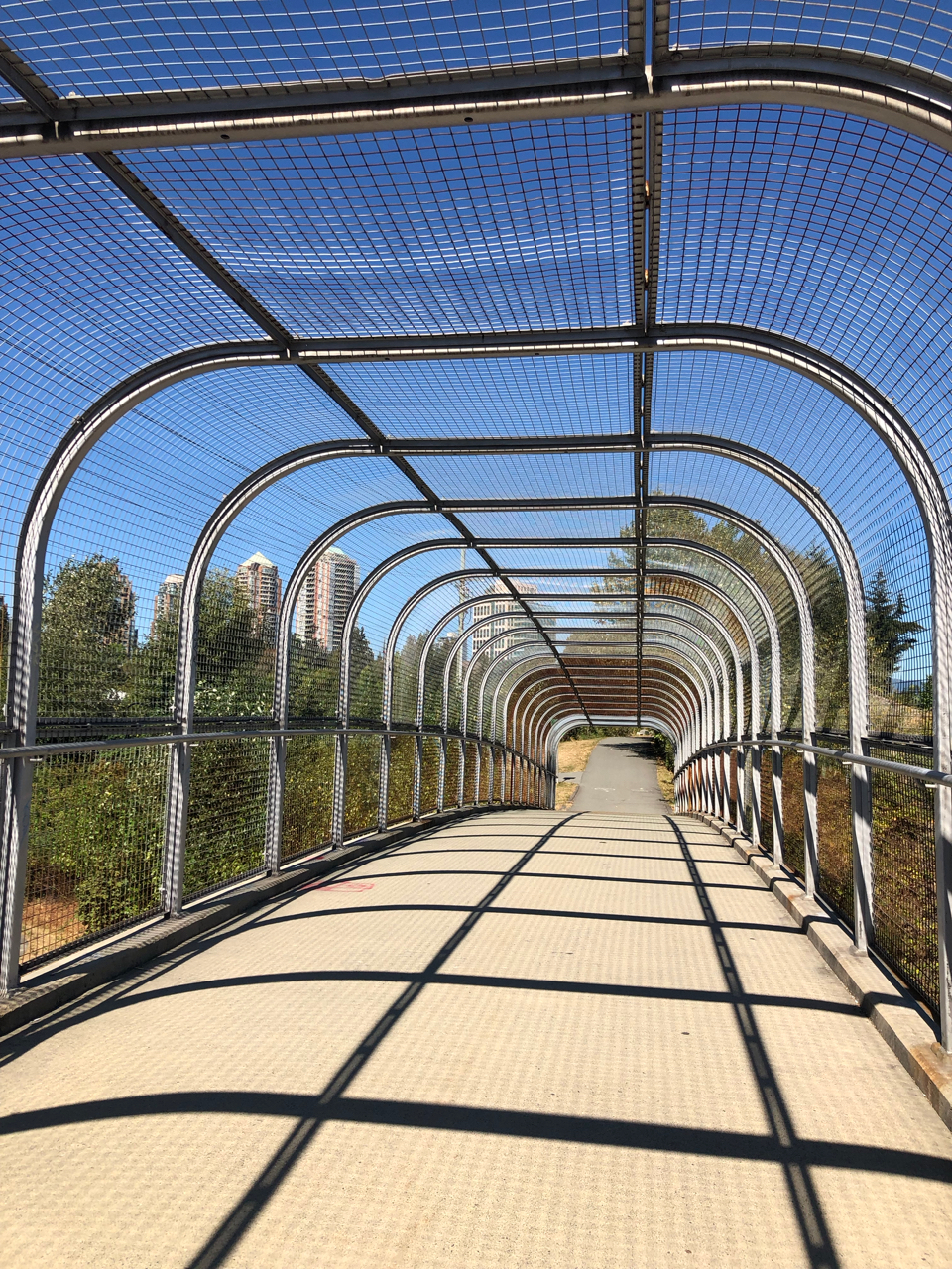
I did my best to appreciate the urban bicycle and transit infrastructure I encountered, such as a covered bike-and-ped bridge and the underside of the SkyTrain.

The SkyTrain!
Shortly after I emerged from that underpass, I saw a sign indicating that the SkyTrain station was on the right.
Wow. Maybe this was just what I needed! It was 2:30 already, and I really wanted to arrive no later than 3:30. Maybe with the train, I could!
I wended my way through narrow winding sidewalks to reach the station. I studied the map to learn which would be my best station to disembark. I looked at fares, and confirmed that I could buy a ticket easily with my credit card. I glanced at the trains I saw on the platform—as well as the turnstiles to get to them—to confirm that loading my rig onto a train would be logistically feasible.
This really might work!
I paid my fare. I navigated the wheelchair-accessible turnstile lane. I stood and waited for the train. It arrived within 60 seconds.
I boarded! It was a tight fit with the rig, but it worked, and no one seemed too annoyed about my presence with it; they walked around it.
I rode for seven stops. I can only imagine how long it would have taken me to bicycle all of that.

As it was, when I disembarked, it took me another half hour to reach Maria’s place. Fortunately, at that point I remembered how to regain phone service by restarting the phone, so I was able to message her and a few other friends to let them know my status.
Maria welcomed me warmly—and told me I might see her adorable-but-skittish cat later in the evening—and I managed to get set up for my Zoom call out on the patio just before 4:00!
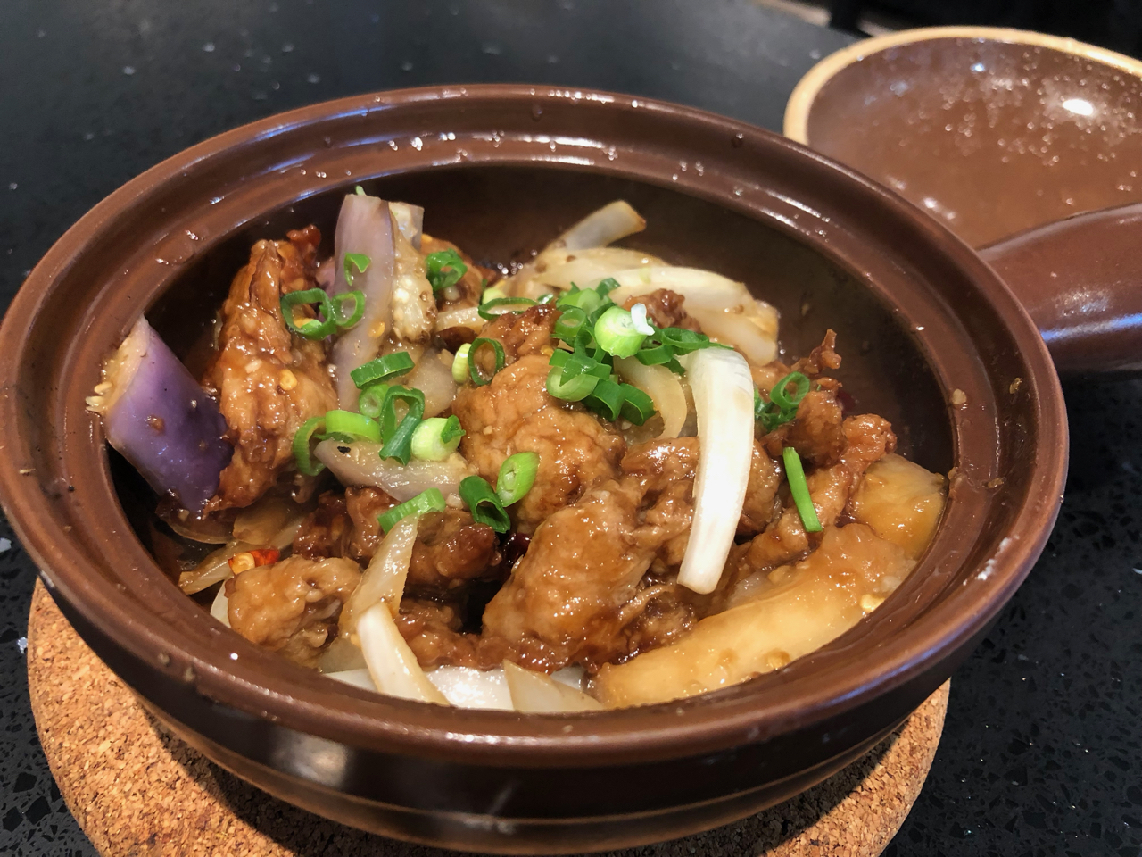
After the Zoom, I took a badly needed shower, and then my wonderful Vancouver friend Lori picked me up to treat me to dinner at a vegan Vietnamese place. I ordered “chicken” with eggplant, and it was exactly what I needed.
We caught up on our lives from the past couple of years since we had last seen each other.
When she dropped me back off at Maria’s place, Cooper the kitty had indeed made an appearance, although he clearly did not want me to get too close.
Maybe tomorrow…?
But now: sleep!
—
Do you have your own dream or project, and would like some support or collaborative brainstorming about it? Use the green “contact” button above to schedule a free one-hour phone or video call with me!
Want to be notified of future blog posts? Use the green “sign up” button to subscribe!
Want to support my vision financially? I am in the process of manifesting $50,000 in lieu of a “salary” for the year of this journey. You can make a one-time or monthly contribution, or even become a Fairy Godfunder! (Heartfelt thanks to all my patrons and supporters!)